|
--What is a watershed?
--What does the watershed map show?
--Why are watersheds important?
--What threatens watersheds and surface waters?
--What do we need to know about watersheds in Plainfield?
--What is next?
-- Where can I get more information?
What is a watershed?
A watershed is the land area that contributes water to a given point, such as a stream or lake. Contributing sources of water for a watershed include (but are not limited to) springs, streams, seeps, ditches, culverts, marshes, wetlands, swamps, and ponds. Eventually, all surface water, some groundwater resources, and precipitation falling within a watershed, drain into a single receiving water body such as a stream, river, lake, or wetland. A watershed boundary is usually delineated by connecting the highest elevation points surrounding a land area.
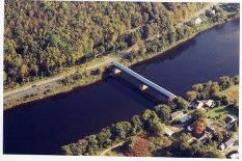
What does the map show?
The town of Plainfield falls within the Connecticut River Mainstream Watershed Group for New Hampshire. As shown on the watershed map (659kb), all of Plainfield's surface waters are encompassed within four watersheds that ultimately flow into the Connecticut River. Surface water covers roughly 14.4 mi2, or 2.5% of Plainfield’s land area, with linear miles of this surface water (shoreline) extending approximately 371mi (including lake and pond perimeters)
The following table presents Plainfield's streams and brooks by watershed.
|
Blow-Me-Down Brook |
Blood's Brook |
Lower Mascoma River |
Plainfield Tributaries |
Bryant Brook |
Cole Brook |
Great Brook |
Beaver Brook |
Burr Brook |
Daniels Brook |
|
Hanchette |
Clay Brook |
Hibbard Brook |
|
|
Penniman Brook |
Hilliard Brook |
|
|
Shipman Brook |
Newton Brook |
|
|
Wine Brook |
|
|
|
Why are watersheds important?
- Watersheds and surface waters provide many of us with our drinking water supply
- Surface waters create recreational opportunities including swimming, boating, and fishing.
- The health of our water sources help define the aesthetic beauty of our community.
- Watersheds define an area in which water quality can be measured and protected. Land use practices within a watershed largely determine the quality of water resources. The challenge of using a watershed approach to manage water quality, however, is that watershed boundaries do not typically follow town, state, or international borders.
What threatens Plainfield’s watersheds and surface waters?
Watersheds and surface waters are threatened by a variety of human activities. Point source pollution threats like leaking fuel tanks or chemical spills often get the most publicity; but they are containable and ‘fixable’ and so are not the largest threats. Non-point source pollution such as the overuse of road salt, fertilizers and pesticides are more challenging because they involve many individuals, government agencies, and businesses; and their effects are cumulative. In addition, development itself can alter run-off and absorption patterns through the removal of natural vegetation and the introduction of impervious surfaces.
What do we need to know?
Managing watersheds, and thus protecting surface waters, is complicated. Watersheds often cover land in several communities, and even a single watershed is made up of many land parcels and businesses with owners who may have competing interests. However, evaluating the quality of our surface waters and identifying pollutant threats is a very reasonable goal. A testing program would also establish base-line data from which we could measure future changes in water quality.
Setting priorities- what’s next?
A combination of research, education and management could include the following:
- Conduct a surface water testing program to establish the quality of our surface waters and to identify pollutants currently in our surface waters.
- Solicit cooperation from surrounding jurisdictions and explore the establishment of “Watershed districts”.
- Review the Town’s compliance with Best Management Practices for the use of road salt and for snow storage.
- Based on the results of a surface water testing program, send educational materials to landowners specific to the needs of the surface waters near their property. Encourage voluntary efforts to reduce non-point source pollution.
For More Information:
See the NH Department of Environmental Services, Watershed Management Bureau.
|