| The Conservation Commission monitors Town lands. This includes marking the borders, cataloging plants and wildlife, monitoring bridge and trail easements and insuring sound management practices. Town Lands include: |
![]() | Burnaps Island -- info |
| Pic Needed | Farnum Lot: This 78-acre tract was purchased by abutting neighbors and gifted to the town. The Upper Valley Land Trust holds a conservation easement on the land. Several existing logging roads and a newly established trail on the property provide interesting walks. A small beaver pond on the western edge of the property is the most environmentally significant feature of the property. A new “Farnum Trails” trailhead parking was established in 2001 on the newly conserved Ira and Sara Townsend Land on Columbus-Jordan Road. This trail head avoids the need to use Farnum Road (Class VI) and the logging landing on the Farnum Lot for parking. Hunting, biking and hiking are allowed on this property. There are also several old cellar holes to be found. |
| Pic Needed | Spencer Lot: Spencer Lot is a 104-acre parcel of land located on Columbus Jordan Road (off Stage Road) which was purchased by the Conservation Commission in 1973. A self-guided nature trail was created in 1981 but has not been maintained in recent years. It is open to the public and may be reached by foot. |
| Pic Needed | Town Forests -- info |
| Pic Needed | Townsend Lot: a property that was provided to the Town under the LCHIP program in association with an easement on the Walker Farm. A portion of this land includes the rock outcroppings on the front face of "Lower French's Ledges" ( between the primary recreational site and the old ski area for KUA). According to the deed, this property is to be managed in a wild state and no hunting is allowed there, however, scenic values are certainly afforded by this property as viewed from Meriden village. |
| Pic Needed | Victor Hewes Memorial Field: A 19.5 acre parcel of land off Stage Road was purchased in 1988. The land is largely open and is currently utilized several times a week by local groups for outdoor recreation. |
| The Conservation Commission also recruits monitors for and oversees reporting on conservation easements held through New Hampshire's Land Conservation Investment Program (LCIP), including those listed below. |
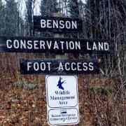 |
Benson Town Forest: the Cole Brook Trail was established as a connector to the Moulton Trail easement in 2001 and is currently signed at the Moulton Trail intersection and at the Cram Hill Road/Cole Brook Trail intersection. The trail was designed for the following uses ‑ hiking, snowshoeing, sking or bicycling. Hunting is also allowed on this property |
 | Morgan Hill (Goslovitch Easement): provides a walking trail to Poverty Lane in Lebanon and includes transitory public use of the lands for recreation (including hunting). A "Bragg Trail" easement is currently being finalized that connects to the Morgan Hill property, adding additional public trail opportunities in this area of town. |
| Pic Needed | Mud Pond -- info |
| Pic Needed | Walker Farm -- info |